UPSC Prelims 2022 Analysis
Subject-Wise Weightage
- Environment & Ecology (18 questions): The highest representation, emphasizing topics like biodiversity, climate change, and maps for environmental hotspots.
- Economy (16 questions): Focused on fiscal policies, budget trends, and government schemes.
- Science & Technology (15 questions): Covered emerging technologies, space missions, and their applications.
- Indian Polity (12 questions): Standard focus on constitutional principles, assertion-based questions, and governance issues.
- Other Notable Areas: International Relations (11), Art & Culture (7), and Geography (10 combined), with many match the following type questions.

Difficulty Analysis
- Easy (25 questions): Covered fundamental NCERT concepts and basic factual recall.
- Medium (48 questions): Required analytical abilities, conceptual clarity, and deeper reasoning.
- Hard (27 questions): Tested multi-dimensional application and assertion-reasoning skills.

Variations in Question Framing
- Multi-Statement (72 questions): Most questions were assertion-reason or "how many of the above are correct?" formats.
- Direct (28 questions): Fact-based, often sourced from NCERT and standard books.
- Match the Following: Commonly seen in Geography, Environment, and Economy questions.

Key Learnings for Future Preparation
- Leverage Easy Questions (25): Build a strong NCERT foundation to secure these marks.
- Prepare for Medium-Difficulty Questions (48): Strengthen analytical abilities to handle the majority of the paper effectively.
- Strategize for Hard Questions (27): Tackle assertion-based and multi-concept questions using elimination techniques.
- Practice Multi-Statement Questions: Since they dominate the paper, mastering them is essential.
- Focus on High-Weightage Subjects: Prioritize Environment, Economy, and Science, given their significant share in the exam.
- Stay Updated with Current Affairs: Particularly for Economy (budget, fiscal policies), Environment, and International Relations, integrate recent developments into your preparation.
Subject-Wise Answer Key
QUESTION 1
GS
Medium
World Geography
Prelims 2022
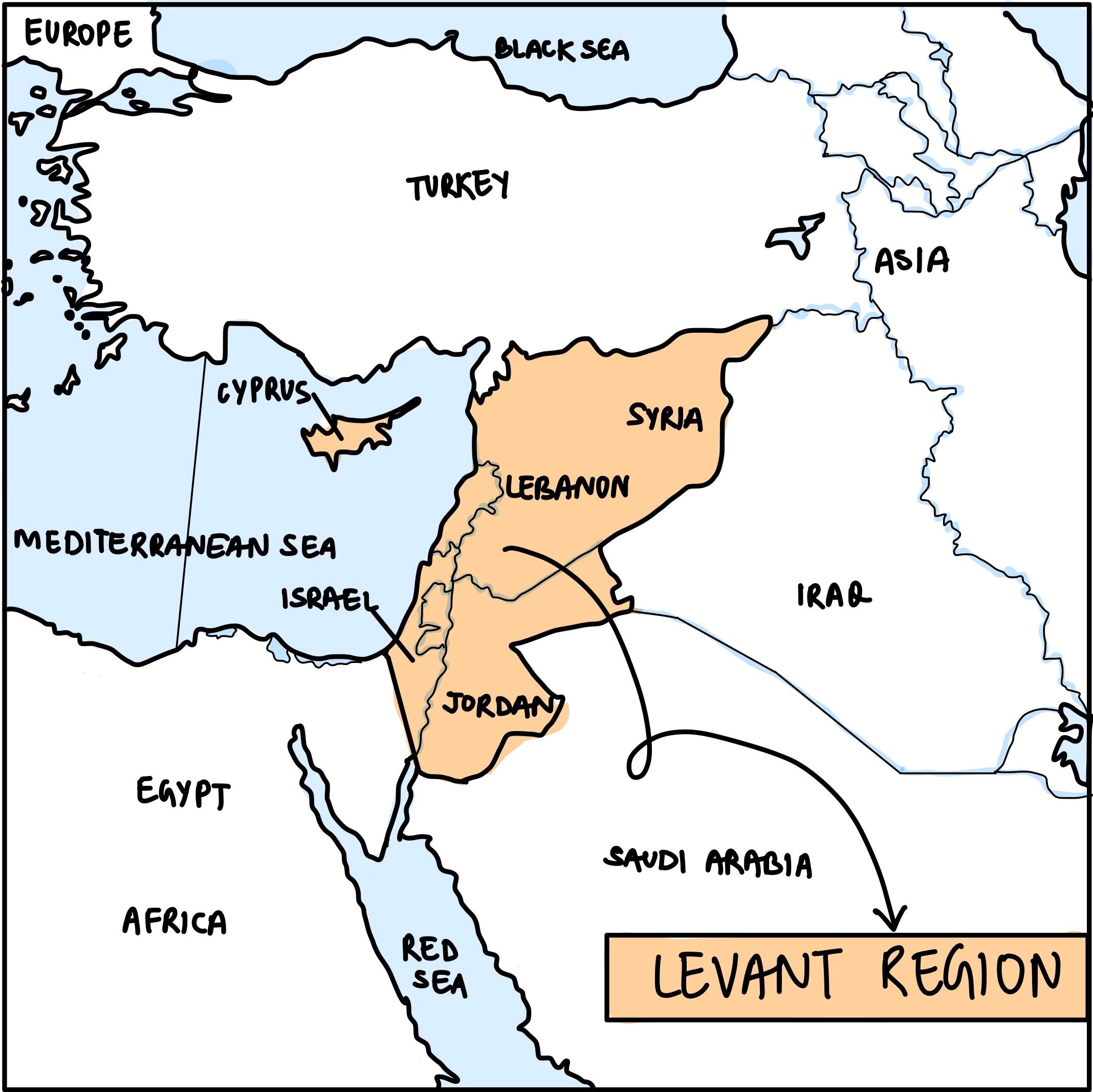
The term "Levant" often heard in the news roughly corresponds to which of the following regions?
A. Region along the eastern Mediterranean shores
B. Region along North African shores stretching from Egypt to Morocco
C. Region along Persian Gulf and Horn of Africa
D. The entire coastal areas of the Mediterranean Sea.
QUESTION 2
GS
Easy
Physical Geography
Prelims 2022
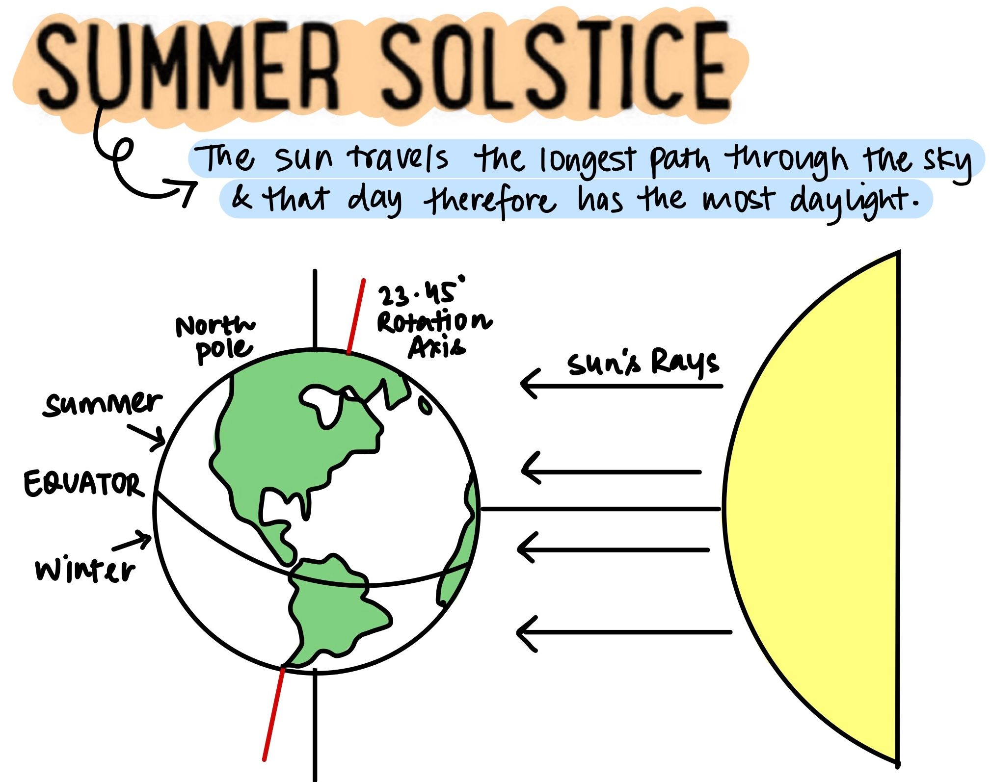
In the northern hemisphere, the longest day of the year normally occurs in the:
A. First half of the month of June
B. Second half of the month of June
C. First half of the month of July
D. Second half of the month of July
QUESTION 3
GS
Medium
World Geography
Prelims 2022
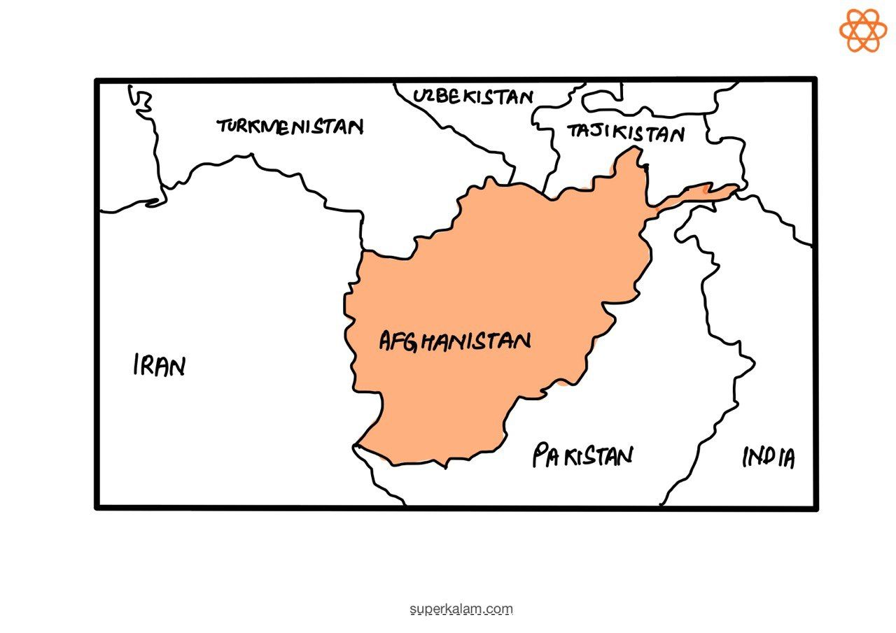
Consider the following countries:
- Azerbaijan
- Kyrgyzstan
- Tajikistan
- Turkmenistan
- Uzbekistan
Which of the above have borders with Afghanistan?
A. 1, 2 and 5 only
B. 1, 2, 3 and 4 only
C. 3, 4 and 5 only
D. 1, 2, 3, 4 and 5
QUESTION 4
GS
Easy
Indian Geography
Prelims 2022
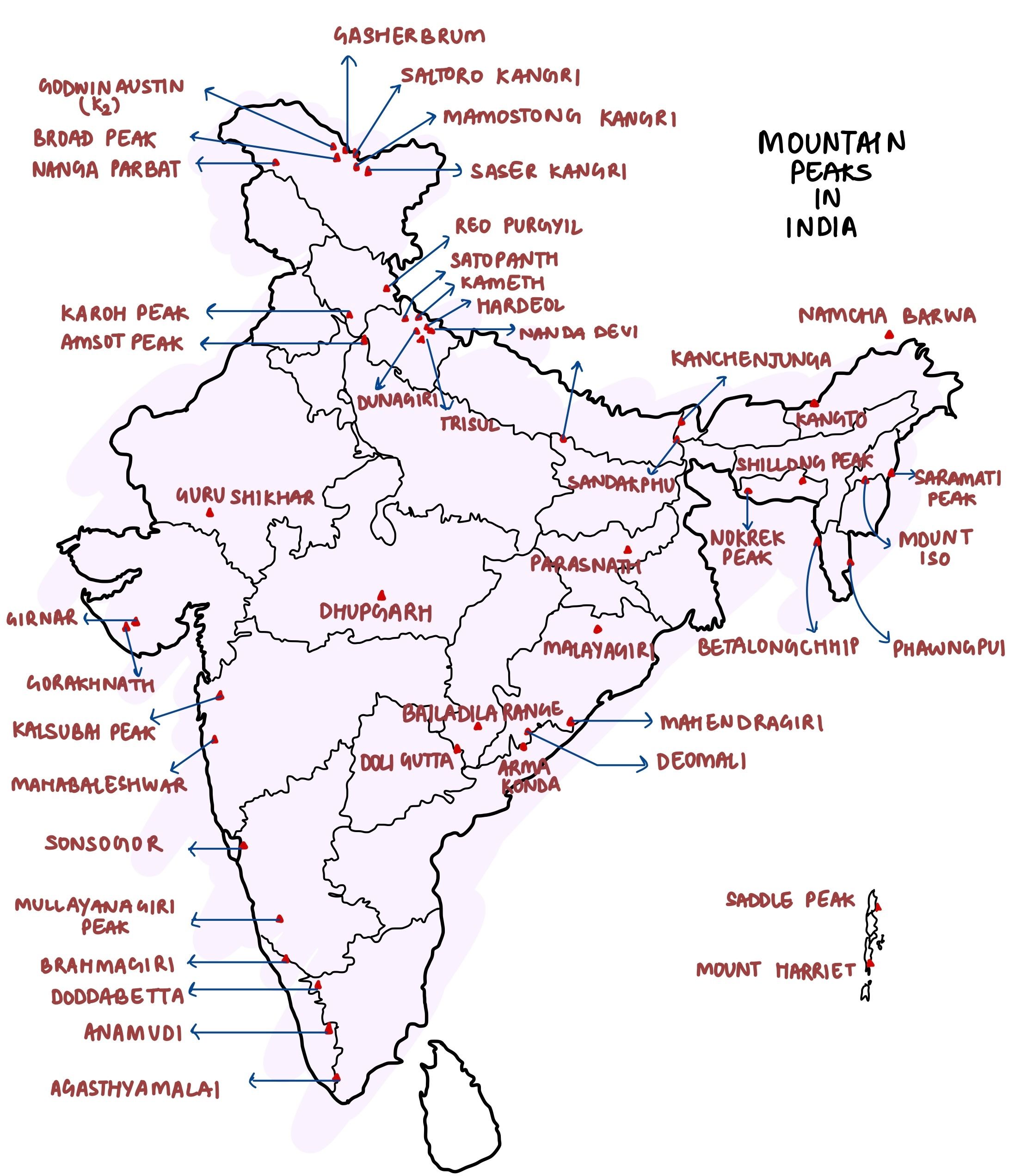
Consider the following pairs:
| Peak | Mountains |
|---|---|
| 1. Namcha Barwa | A. Garhwal Himalaya |
| 2. Nanda Devi | B. Kumaon Himalaya |
| 3. Nokrek | C. Sikkim Himalaya |
Which of the statements given above is/are correctly matched?
A. 1 and 2
B. 2 only
C. 1 and 3
D. 3 only
QUESTION 5
GS
Hard
Physical Geography
Prelims 2022
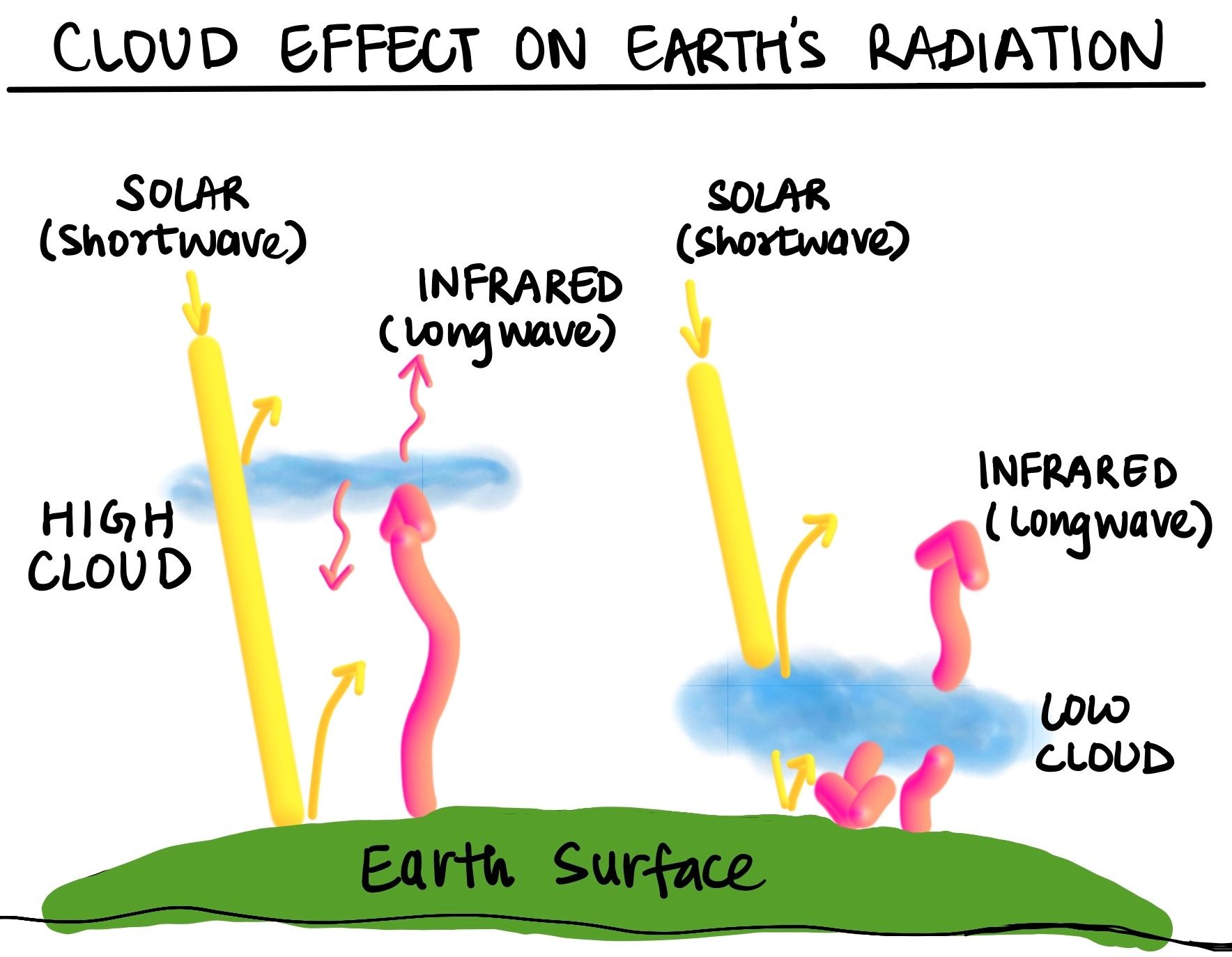
Consider the following statements:
- High clouds primarily reflect solar radiation and cool the surface of the Earth.
- Low clouds have a high absorption of infrared radiation emanating from the Earth's surface and thus cause a warming effect.
Which of the statements given above is/are correct?
A. 1 only
B. 2 only
C. Both 1 and 2
D. Neither 1 nor 2
QUESTION 6
GS
Medium
World Geography
Prelims 2022
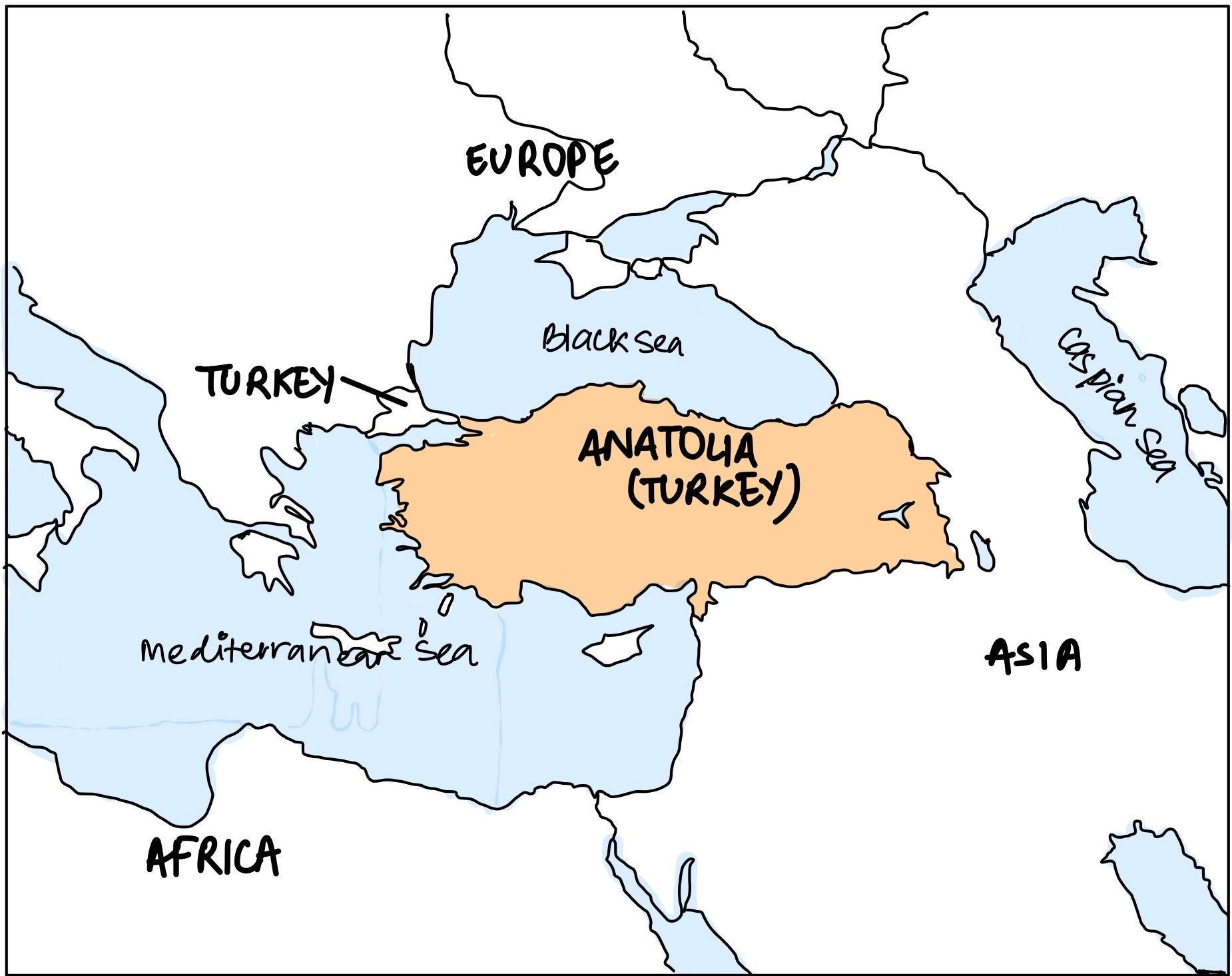
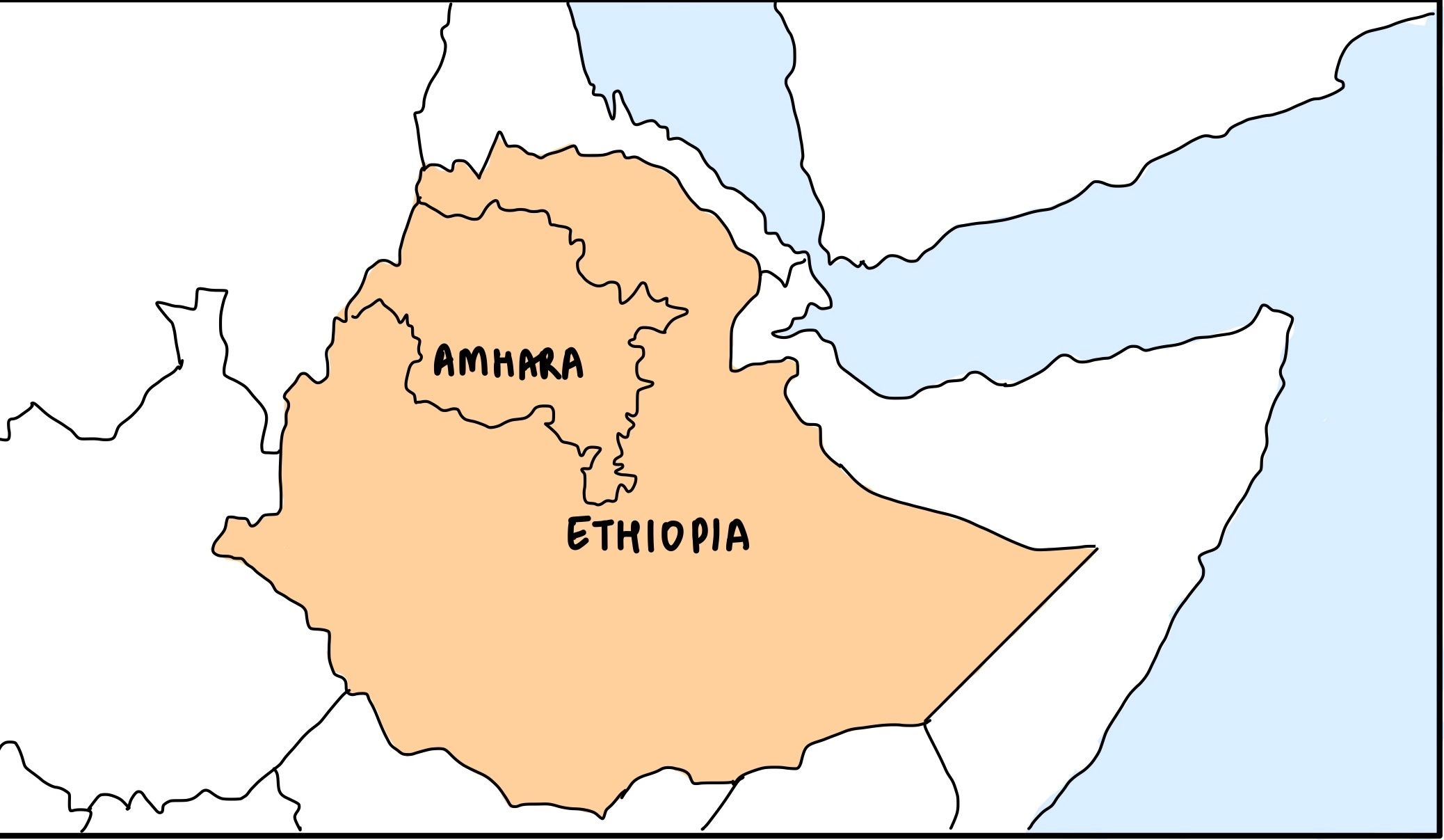
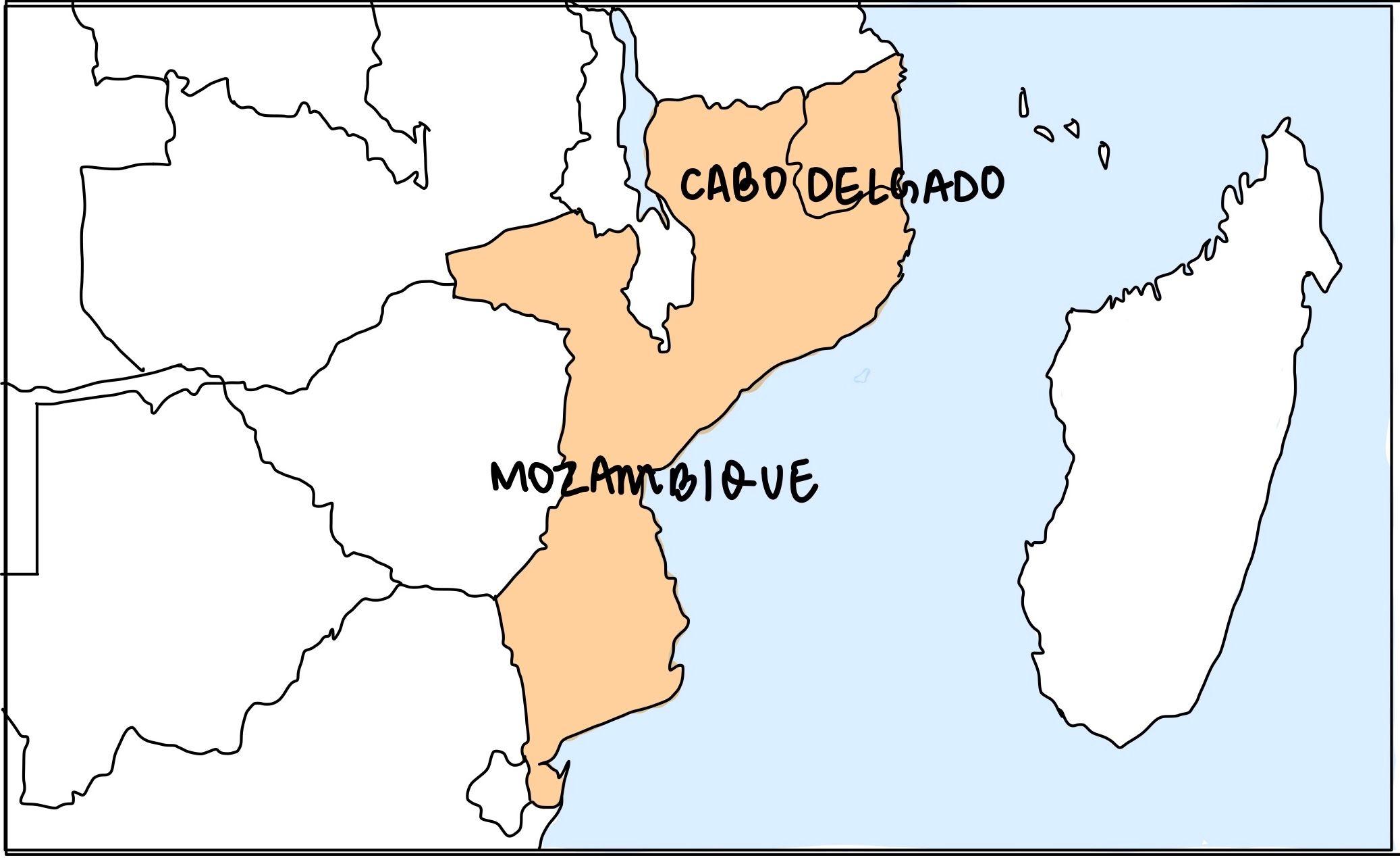
Consider the following pairs:
Region often mentioned in the news - Country
- Anatolia – Turkey
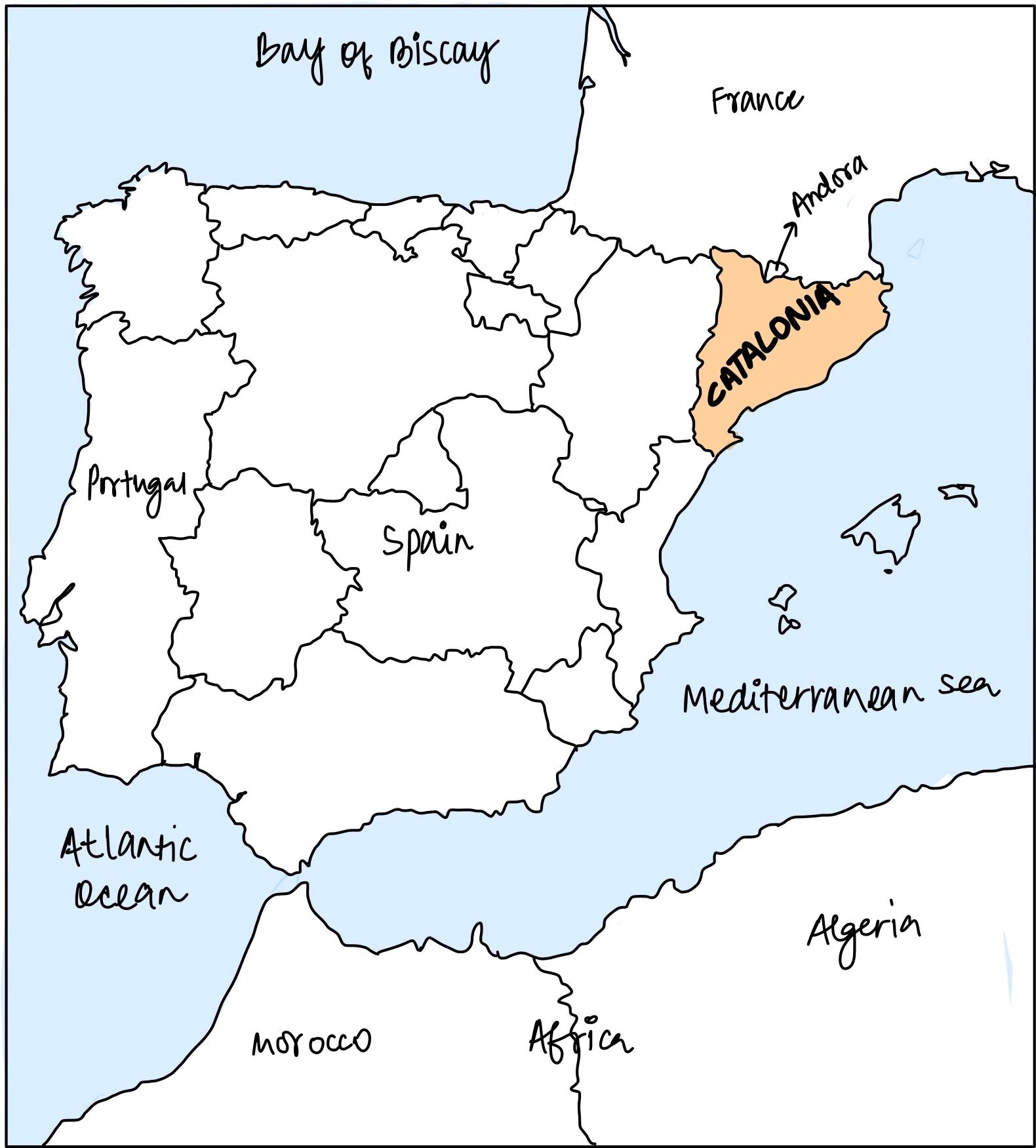
- Amhara – Ethiopia
- Cabo Delgado –Spain
- Catalonia – Italy
How many pairs given above are correctly matched?
A. Only one pair
B. Only two pairs
C. Only three pairs
D. All four pairs
QUESTION 7
GS
Hard
Indian Geography
Prelims 2022
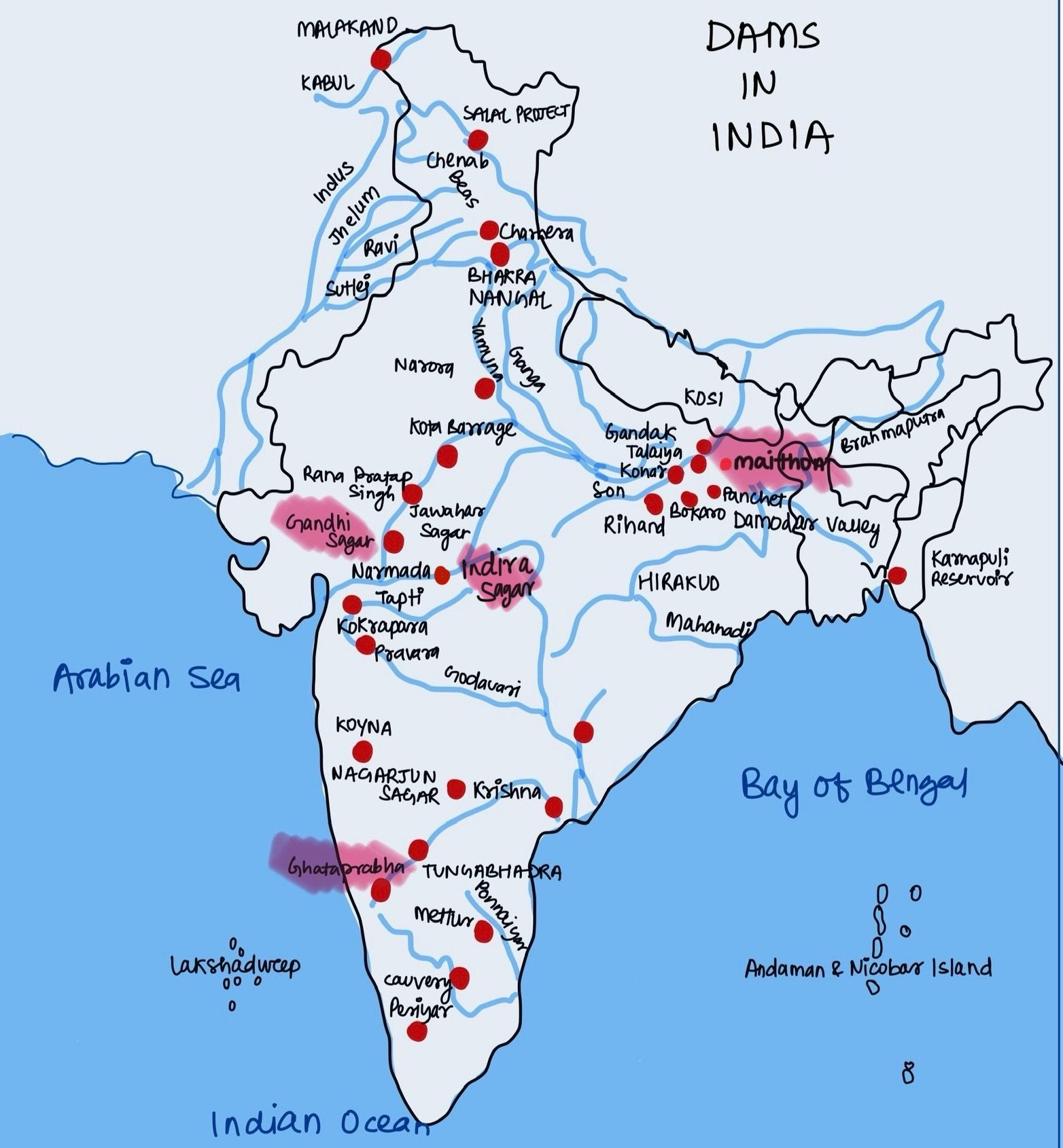
Consider the following pairs:
Reservoirs — States
- Ghataprabha — Telangana
- Gandhi Sagar — Madhya Pradesh
- Indira Sagar — Andhra Pradesh
- Maithon — Chhattisgarh
How many pairs given above are not correctly matched?
A. Only one pair
B. Only two pairs
C. Only three pairs
D. All four pairs
QUESTION 8
GS
Medium
Indian Geography
Prelims 2022
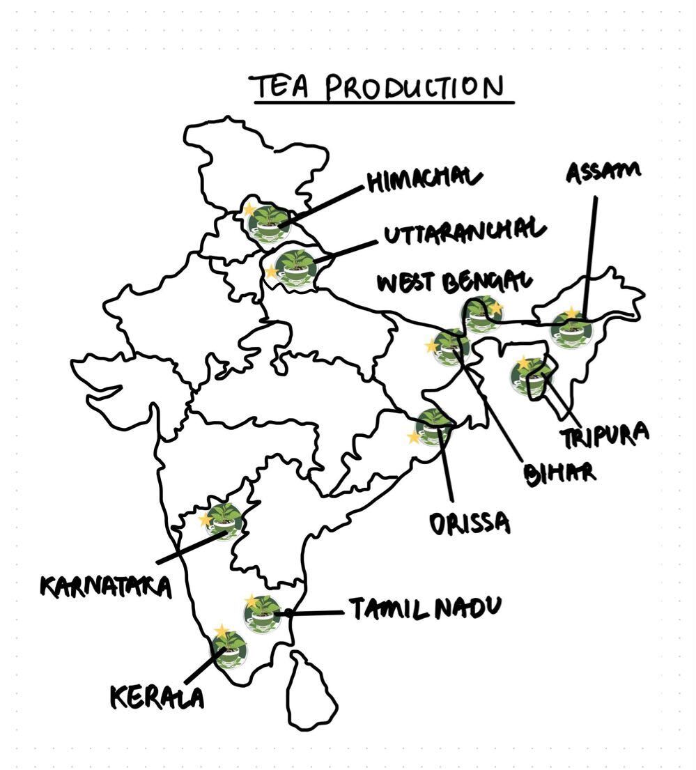
Consider the following States:
- Andhra Pradesh
- Kerala
- Himachal Pradesh
- Tripura
How many of the above are generally known as tea-producing States?
A. Only one State
B. Only two States
C. Only three States
D. All four States
QUESTION 9
GS
Easy
Indian Geography
Prelims 2022
With reference to India, consider the following statements:
- Monazite is a source of rare earths.
- Monazite contains thorium.
- Monazite occurs naturally in the entire Indian coastal sands in India.
- In India, Government bodies only can process or export monazite.
Which of the statements given above are correct?
A. 1, 2 and 3 only
B. 1, 2 and 4 only
C. 3 and 4 only
D. 1, 2, 3 and 4
QUESTION 10
GS
Medium
Indian Geography
Prelims 2022
Gandikota canyon of South India was created by which one of the following rivers?
A. Cauvery
B. Manjira
C. Pennar
D. Tungabhadra