How can Artificial Intelligence (AI) and drones be effectively used along with GIS and RS techniques in locational and areal planning?
How can Artificial Intelligence (AI) and drones be effectively used along with GIS and RS techniques in locational and areal planning?
AI, drones, GIS, and RS techniques have transformed locational and areal planning into precise, data-driven systems. They allow planners to collect real-time data, analyze spatial patterns, and make better, faster decisions.
Projects like the Survey of India’s SVAMITVA initiative, which mapped 6.62 lakh villages, demonstrate the power of these technologies in improving land management and planning.
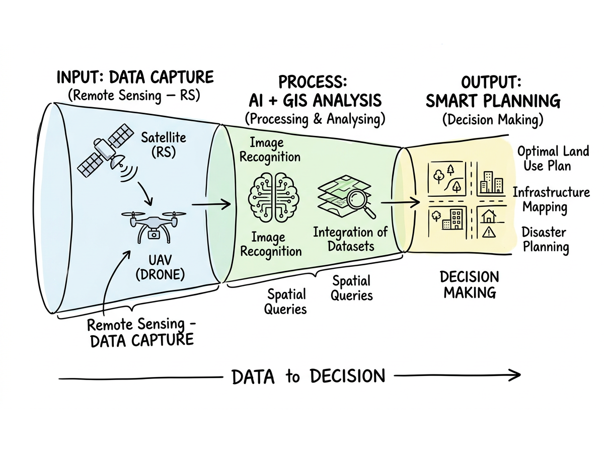
Use of Technology in Smart Planning Process
AI and Drones in Locational Planning
| Technology | Application | Accuracy | Coverage | Key Uses |
|---|---|---|---|---|
| AI-powered drones | Site selection and terrain analysis | 1–5 cm precision | 10,000 sq km/week | Automated site selection, real-time adjustments for projects |
| Machine learning | Land suitability and zoning mapping | ~95% accuracy | State-level coverage | Predictive modeling, risk assessment, and urban growth projections |
| Computer vision | Infrastructure and asset monitoring | Real-time updates | City-wide surveillance | Infrastructure optimization, hazard mapping, and quick decision-making |
AI and Drones in Areal Planning
- Land Use Classification: Maharashtra’s AI-based crop mapping achieved 92% accuracy across 3.07 lakh hectares, improving crop pattern optimization and precision farming strategies.
- Urban Growth Modeling: Bengaluru’s AI-GIS system predicts urban sprawl with 85% precision, enabling proactive zoning and sustainable urban design.
- Resource Distribution: Automated analysis helps governments identify underserved areas, ensuring equitable allocation of public services and utilities.
- Environmental Impact Monitoring: Drones and AI regularly track changes in vegetation cover, water quality, and air pollution to inform climate adaptation policies.
- Disaster Management: Uttarakhand integrates drones and GIS to monitor 13,000 sq km of landslide-prone zones, supporting early warning systems and efficient relief planning.
- Biodiversity Planning: High-resolution imagery and AI-based analytics identify habitat loss and monitor wildlife corridors for conservation strategies.
Implementation Examples
- Smart Cities Mission: Surat uses AI-drone integration for traffic management and urban design.
- Agricultural Planning: Punjab’s soil health mapping project covers 5.03 million hectares.
- Forest Management: Odisha uses AI-powered systems to track 37% of its forest cover for conservation.
- Mining Surveillance: Chhattisgarh employs drones and AI to monitor and curb illegal mining.
The integration of AI, drones, GIS, and RS has created a comprehensive ecosystem for spatial planning, ensuring accuracy, efficiency, and sustainability.
Backed by policies like the National Geospatial Policy 2022 and initiatives under Digital India, these technologies are redefining how locational and areal planning drive smarter, more resilient, and sustainable development across sectors.
Answer Length
Model answers may exceed the word limit for better clarity and depth. Use them as a guide, but always frame your final answer within the exam’s prescribed limit.
In just 60 sec
Evaluate your handwritten answer
- Get detailed feedback
- Model Answer after evaluation
Model Answers by Subject
Crack UPSC with your
Personal AI Mentor
An AI-powered ecosystem to learn, practice, and evaluate with discipline

