Analyze the role of satellite-based technologies in achieving climate-smart agriculture and food security in India.
Analyze the role of satellite-based technologies in achieving climate-smart agriculture and food security in India.
Satellite-based technology, led by ISRO’s Earth Observation (EO) capabilities, acts as a force multiplier for Climate-Smart Agriculture (CSA), enabling resilient food systems against the vagaries of the South-West Monsoon and climate change.
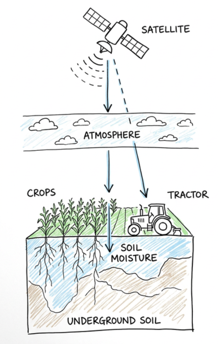
Satellite-Based Agriculture Linking Remote Sensing, Farm Operations, Crops and Soil Monitoring
Role in Achieving Climate-Smart Agriculture (CSA)
-
Crop Condition Monitoring: Periodic assessment of crop health using multispectral data.
- Eg: The FASAL (Forecasting Agriculture using Space, Agrometeorology and Land-based observations) project.
-
Soil Moisture Mapping: Utilizing microwave remote sensing for irrigation scheduling.
- Eg: Data from RISAT-1 and NISAR (upcoming) helps in precision moisture estimation.
-
Precision Resource Application: Optimizing fertilizer and pesticide use through Variable Rate Technology (VRT).
- Eg: High-resolution imagery from Cartosat series for site-specific nutrient management.
-
Agro-Meteorological Advisories: Providing real-time weather updates to mitigate climate risks.
- Eg: INSAT-3DR provides vertical profiles of temperature and humidity for local forecasts.
-
Carbon Sequestration Tracking: Monitoring biomass and vegetation indices to quantify carbon sinks.
- Eg: Use of Normalized Difference Vegetation Index (NDVI) to assess agro-forestry health.
-
Methane Emission Monitoring: Identifying high-emission zones in paddy cultivation for mitigation.
-
Pest and Disease Surveillance: Early warning systems based on environmental triggers like humidity.
- Eg: Satellite data used to track Locust swarms in Rajasthan and Gujarat.
-
Water Resource Management: Mapping canal networks and aquifer recharge zones.
- Eg: Bhuvan-Bhujal portal for groundwater prospecting.
Role in Ensuring Food Security
-
Yield Prediction: Pre-harvest production estimates for better price and stock management.
- Eg: CHAMAN project for mapping and yield estimation of horticulture crops.
-
Crop Insurance Settlement: Objective damage assessment for faster payouts under Pradhan Mantri Fasal Bima Yojana (PMFBY).
-
Drought Vulnerability Assessment: Early detection of agricultural drought through moisture stress monitoring.
- Eg: The National Agricultural Drought Assessment and Monitoring System (NADAMS).
-
Potential Fishing Zones (PFZ): Guiding artisanal fishers to productive areas, increasing marine food supply.
- Eg: Oceansat-2 data disseminated via INCOIS.
-
Wasteland Reclamation: Identifying fallow lands suitable for cultivation to increase net sown area.
- Eg: Wasteland Atlas of India developed using remote sensing.
-
Supply Chain Optimization: Integrating GIS with logistics to reduce post-harvest losses.
-
Targeted Public Distribution: Mapping food demand vs. production surplus to stabilize the PDS supply chain.
Way Forward
-
Digital Agriculture Mission: Integration of satellite data with AI and IoT to democratize insights for smallholders.
-
Hyper-local Data: Enhancing spatial resolution to provide farm-level (rather than district-level) advisories.
Integrating space technology into the agrarian landscape is essential to achieve SDG 2 (Zero Hunger) and the Paris Agreement goals by building a climate-resilient Viksit Bharat.
Answer Length
Model answers may exceed the word limit for better clarity and depth. Use them as a guide, but always frame your final answer within the exam’s prescribed limit.
Evaluate this PYQ now
Write your answer & evaluate in just 60 seconds




500+ students evaluated
Model Answers from
- 2026Indian Geography15 MarksView Answer
Analyze the major drivers of human-induced land-use changes in India and their geographical consequences.
- 2026Indian Geography10 MarksView Answer
"Water resources are both an asset and a source of conflict in South Asia." Examine this statement giving examples.
Model Answers by Subject


Crack UPSC with your
Personal AI Mentor
An AI-powered ecosystem to learn, practice, and evaluate with discipline