GS 1: Physical GeographyGS 3: Disaster ManagementPrelims
How do cyclones form and how are they measured?, Pg8
Understanding cyclone formation: Warm waters, Coriolis effect, and low wind shear drive these destructive forces of nature.
Practice MCQs
818 Students attempted
Key Highlights:
- Cyclones are powerful storms that draw heat from tropical waters, causing destructive winds, rainfall, and storm surges.
- Cyclone formation requires warm sea surface temperatures (above 26.5°C), atmospheric instability, and sufficient Coriolis force.
- The India Meteorological Department classifies cyclones from 'depression' (31-49 km/hr) to 'super cyclonic storm' (>222 km/hr).
- Meteorologists use ground observations, aircraft, satellites, and buoys to measure and monitor cyclones.
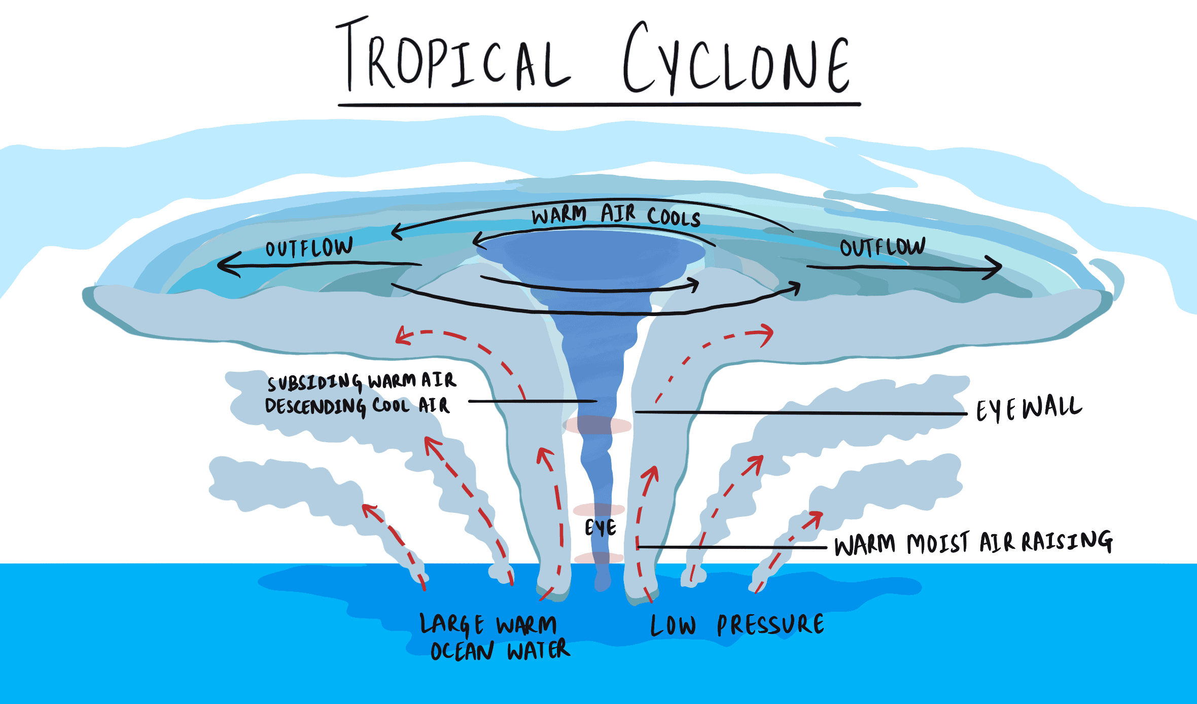
tropical-cyclone.png
Detailed Insights:
- Tropical cyclones originate from low-pressure areas with thunderstorms, requiring specific oceanic and atmospheric conditions to intensify.
- Warm sea surface temperatures lead to moist air rising, releasing latent heat, and creating a self-reinforcing cycle of convection.
- The Coriolis force, caused by Earth's rotation, induces rotation in cyclones, but is weakest near the equator, limiting cyclone formation within 5 degrees of latitude.
- Vertical wind shear, the difference in wind speed and direction, must be low to prevent disruption of a cyclone's circulation.
- A cyclone's development can lead to the formation of a calm 'eye' surrounded by an 'eyewall' with intense winds and rainfall.
- Cyclone intensity is classified by maximum sustained wind speed and central pressure, with variations in classification schemes across ocean basins.
- Satellites are crucial for monitoring cyclones, using infrared, visible, and microwave sensors to assess storm intensity, structure, and rainfall.
- Forecasting cyclone paths and intensity is challenging due to the complexity of atmospheric and oceanic conditions, but has improved significantly with advancements in technology.
Key Concepts Involved:
- Cyclone: A large-scale air mass that rotates around a strong center of low atmospheric pressure.
- Coriolis Force: A force that deflects moving objects on Earth due to the planet's rotation.
- Wind Shear: The variation in wind velocity occurring along a direction at right angles to the wind's direction and tending to exert a turning force.

SuperKalam is your personal mentor for UPSC preparation, guiding you at every step of the exam journey.
Download the App


STUDY RESOURCES
CONTACT US
ⓒ Snapstack Technologies Private Limited