GS 3: Science & TechnologyPrelimsGS 2: Government policies and interventions for development in various sectorsGS 3: Indigenization of Technology and New Technology DevelopmentGS 3: Space Technology
ISRO's NavIC System Can No Longer Provide Navigation Data Independently: Govt, Pg9
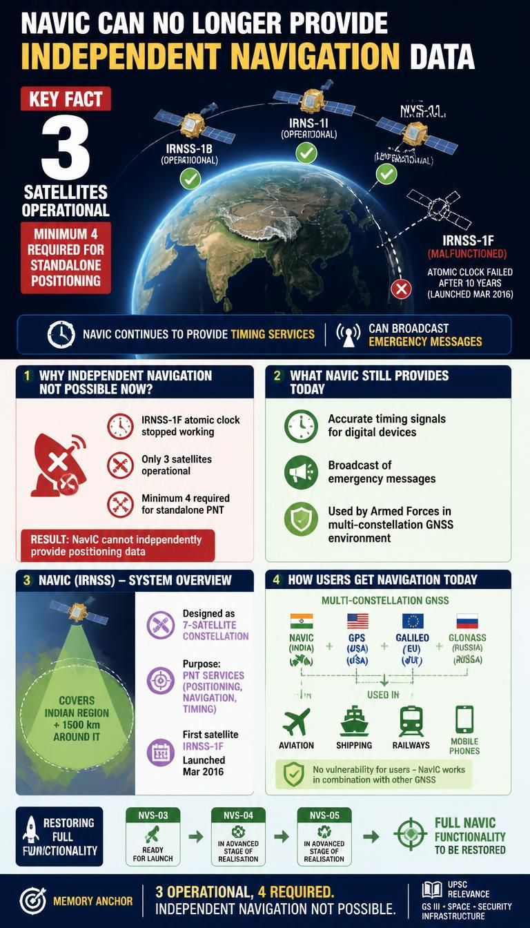
Government admits ISRO's NavIC system can no longer provide independent navigation data after satellite failure, requiring minimum four operational satellites.
Practice MCQs
811 Students attempted
Key Highlights:
- The Indian government has acknowledged that the NavIC system can no longer independently provide navigation data.
- This is due to the malfunction of the IRNSS-1F satellite, whose on-board atomic clock stopped functioning after completing its 10-year mission life.
- Currently, only three satellites—IRNSS-1B, IRNSS-1I, and NVS-01—are operational for Positioning, Navigation, and Timing (PNT) services, while a minimum of four are required for standalone positioning.
- Despite this, NavIC continues to provide timing services and is utilized by the armed forces within a multi-constellation Global Navigation Satellite System (GNSS) environment.
- The next NavIC satellite, NVS-03, is ready for launch, with NVS-04 and NVS-05 in advanced stages of realization to restore full functionality.
NAVIC.jpg
Detailed Insights:
- NavIC, officially known as the Indian Regional Navigation Satellite System (IRNSS), was designed as a seven-satellite constellation.
- Its primary objective is to provide accurate positioning data over the Indian subcontinent and an area extending 1500 km around it.
- The IRNSS-1F satellite, launched in March 2016, was crucial for the system's independent operation.
- The system still offers accurate time signals for digital devices and can broadcast emergency messages.
- Most end-user applications in aviation, shipping, railways, and mobile phones use GNSS receivers, allowing them to integrate signals from other systems like U.S. GPS, EU's Galileo, and Russia's Glonass.
- The government has stated that there is no vulnerability for users as NavIC is primarily used in a multi-constellation environment.
Key Concepts Involved:
- NavIC (Navigation with Indian Constellation): India's indigenous regional satellite navigation system, formerly known as IRNSS.
- IRNSS (Indian Regional Navigation Satellite System): The official name for the constellation of satellites that form the NavIC system.
- GNSS (Global Navigation Satellite System): A general term for satellite navigation systems that provide autonomous geo-spatial positioning.
- PNT Services (Positioning, Navigation, Timing): The core functionalities provided by satellite navigation systems.
- Atomic Clock: A highly precise timekeeping device essential for accurate positioning in satellite navigation systems.

SuperKalam is your personal mentor for UPSC preparation, guiding you at every step of the exam journey.
Download the App


STUDY RESOURCES
CONTACT US
ⓒ Snapstack Technologies Private Limited