Differentiate the causes of landslides in the Himalayan region and Western Ghats.
Differentiate the causes of landslides in the Himalayan region and Western Ghats.
Recent landslide disasters in Wayanad (2024) and Kedarnath highlight the distinct causative factors affecting India's two major mountain systems.
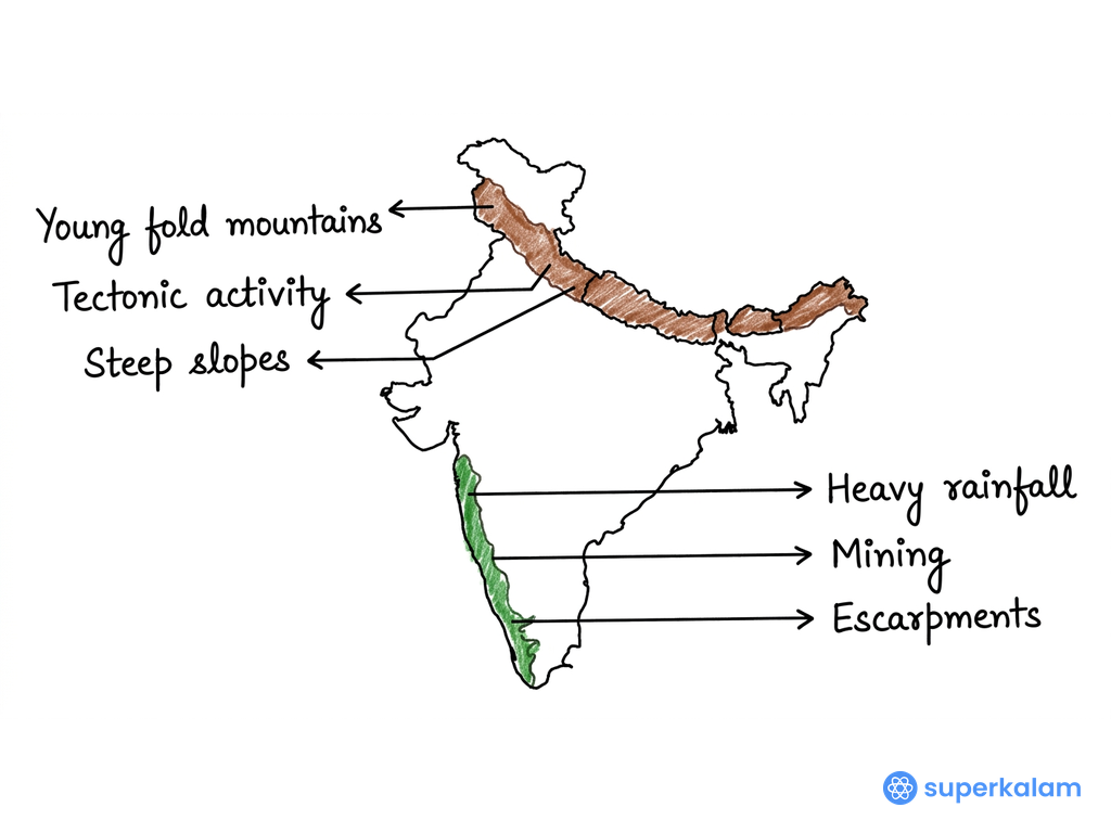
India map showing the Himalayan region
Causes of Landslides in the Himalayan Region
• Geological Instability: Young fold mountains (formed 50 million years ago) with active tectonic movement and numerous fault lines creating structurally weak zones
• Seismic Activity: Located on Indo-Australian and Eurasian plate boundary, experiencing frequent earthquakes that trigger slope failures and rock displacement
• Steep Terrain: Extremely steep slopes (often >45°) with highly fractured rock masses and loose sedimentary deposits increasing gravitational pull
• Freeze-Thaw Cycles: High altitude regions experience periglacial weathering where repeated freezing-thawing weakens rock structure and creates debris
• Infrastructure Development: Unplanned road construction and tunnel boring (like Char Dham project) destabilizing mountain slopes through vibrations and slope cutting
Causes of Landslides in Western Ghats
• Ancient but Stable Geology: Precambrian crystalline rocks (over 2.5 billion years old) with stable basement but weathered upper layers forming unstable regolith
• Intense Monsoon Precipitation: Receives 3,000-7,000mm annual rainfall concentrated in 3-4 months, causing rapid soil saturation and pore pressure increase
• Lateritic Soil Formation: Deep chemical weathering creates thick lateritic soil layers that become unstable when water-logged during monsoons
• Forest Degradation: Deforestation for plantations (coffee, tea, spices) removes root binding, reducing slope stability and increasing surface runoff
• Mining Activities: Quarrying and iron ore extraction in states like Goa and Karnataka creating artificial steep slopes and removing natural slope support
| Aspect | Himalayas | Western Ghats |
|---|---|---|
| Primary Cause | Tectonic instability + freeze-thaw | Heavy rainfall + soil saturation |
| Rock Type | Young sedimentary/metamorphic | Ancient crystalline with weathered layer |
| Seasonality | Year-round (earthquakes + monsoon) | Mainly monsoon season |
The Geological Survey of India's National Landslide Susceptibility Mapping program (2024) covers both regions, enabling targeted early warning systems and risk mitigation strategies.
Answer Length
Model answers may exceed the word limit for better clarity and depth. Use them as a guide, but always frame your final answer within the exam’s prescribed limit.
Evaluate this PYQ now
Write your answer & evaluate in just 60 seconds




500+ students evaluated
Model Answers by Subject


Crack UPSC with your
Personal AI Mentor
An AI-powered ecosystem to learn, practice, and evaluate with discipline