GS 3: Internal SecurityGS 1: Indian GeographyGS 3: EconomyPrelims
Why Zojila tunnel breakthrough is a boost for military mobility, Pg12
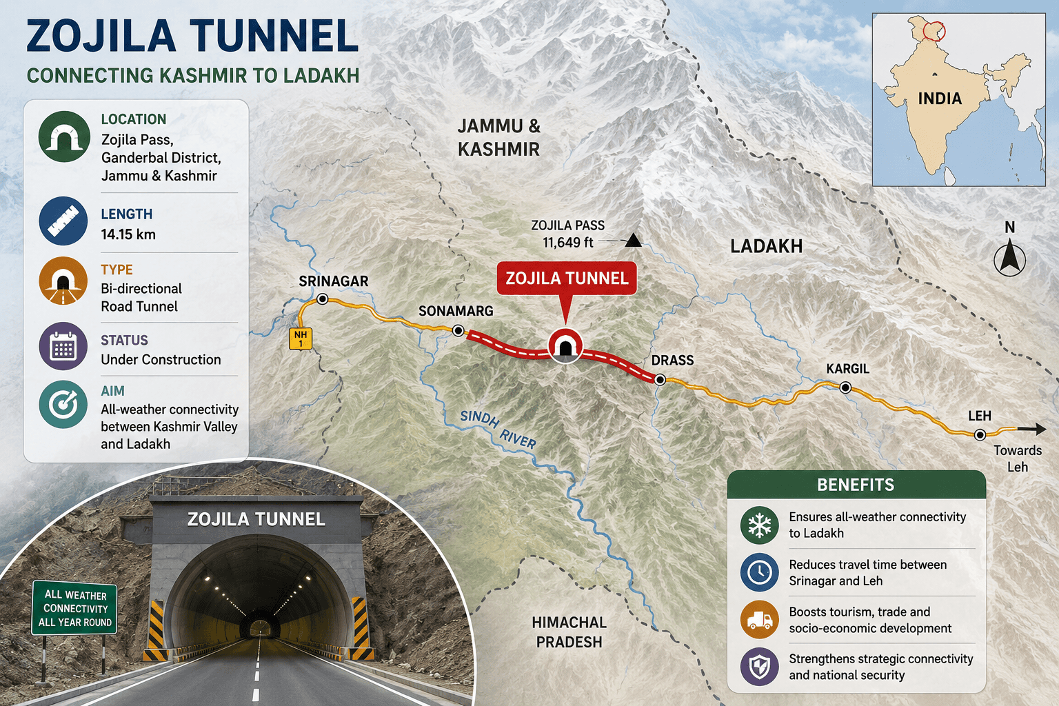
Zojila tunnel, world's longest high-altitude bi-directional road, achieves breakthrough, ensuring year-round military mobility and civilian access to strategic Ladakh.
Practice MCQs
855 Students attempted
Key Highlights:
- The Zojila tunnel has achieved a significant breakthrough with the completion of its excavation phase.
- It is the world's longest high-altitude bi-directional road tunnel, connecting Kashmir valley and Ladakh.
- The 13-km tunnel, situated at an altitude of 11,758 feet, is targeted for completion by February 2028.
- This project will provide all-weather connectivity to Ladakh, bypassing the treacherous Zojila Pass.
- The tunnel significantly enhances military mobility and reduces the defense forces' reliance on airlifts in the strategic Himalayan region.
Zojila Tunnel.png
Detailed Insights:
- The Zojila tunnel forms the centerpiece of the larger 30,894-km Zojila project, aimed at ensuring year-round access to Ladakh.
- It will reduce the distance from Sonamarg to Drass by 27 km and cut travel time by more than two hours.
- All-weather connectivity is crucial for defense forces, boosting maneuverability in case of hostilities on the Line of Actual Control (LAC) or Line of Control (LoC).
- The tunnel offers greater protection from enemy surveillance and artillery fire, vulnerabilities evident during the 1999 Kargil War.
- The Z-Morh tunnel, another key project on the Srinagar-Leh highway, was opened in January last year, complementing the Zojila project.
- Remaining works include widening vertical shafts, completing the inner concrete lining, and installing drainage, ventilation, and fire-fighting systems.
Key Concepts Involved:
- All-weather connectivity: Ensuring year-round access and transport despite extreme weather conditions and snowfall.
- Line of Actual Control (LAC): The demarcation line separating Indian-controlled territory from Chinese-controlled territory.
- Line of Control (LoC): A military control line between the Indian and Pakistani parts of the former princely state of Jammu and Kashmir.
- Strategic Infrastructure: Projects vital for national security, economic development, and defense capabilities of a nation.

SuperKalam is your personal mentor for UPSC preparation, guiding you at every step of the exam journey.
Download the App


STUDY RESOURCES
CONTACT US
ⓒ Snapstack Technologies Private Limited