GS 3: Environment & EcologyGS 3: Science & TechnologyPrelims
Forest Survey of India stops its AI-based fortnightly alerts to states on deforestation, Pg1
Forest Survey of India halts AI-driven Anavaran deforestation alert system after 22 months, states raise concerns over monitoring gap.
Practice MCQs
811 Students attempted
Key Highlights:
- The Forest Survey of India (FSI) has stopped its Anavaran-Deforestation Alert System, which provided fortnightly deforestation alerts to states.
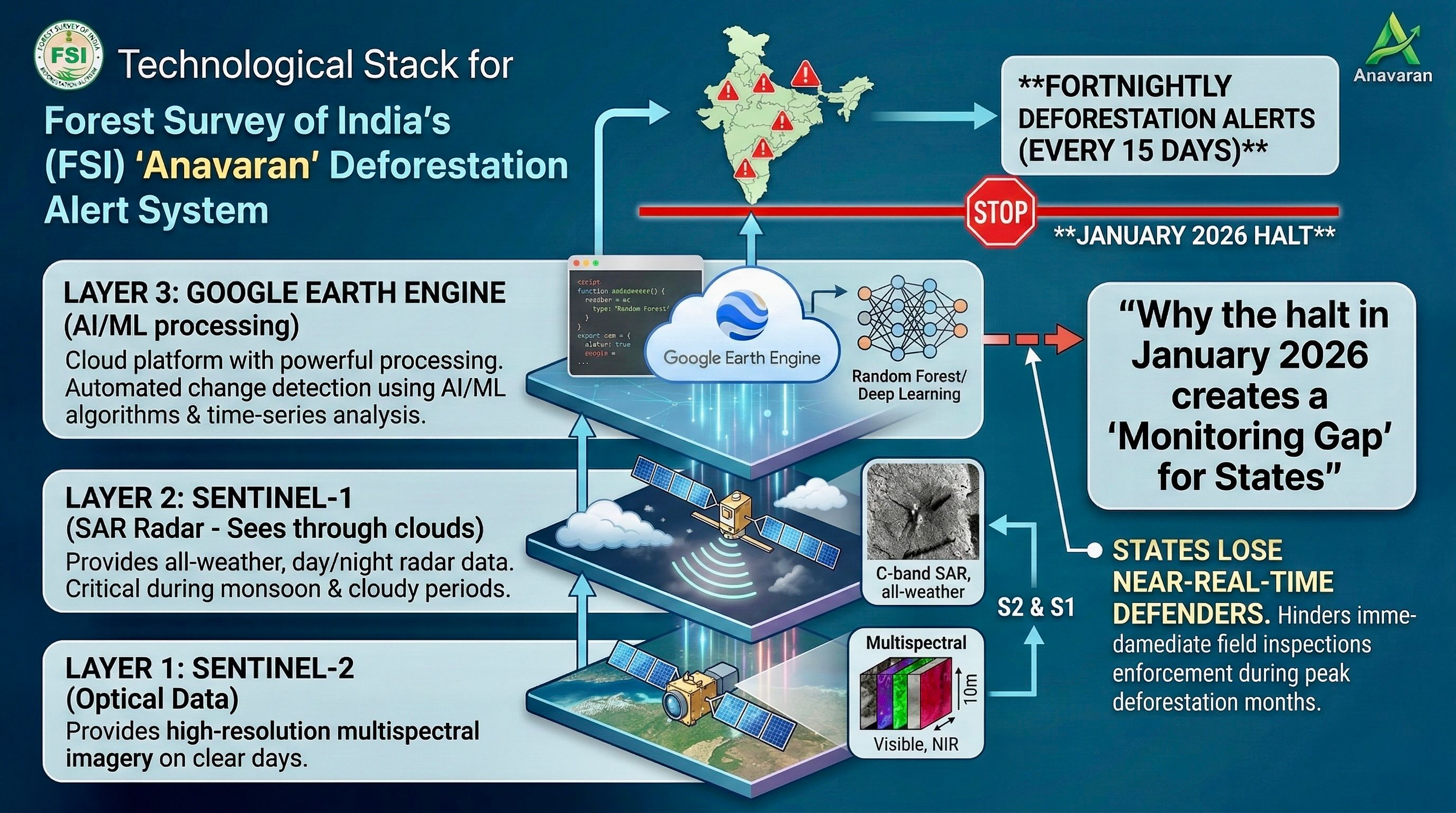
- The AI-based portal used satellite data and machine learning to identify and alert states to forest cover loss every 15 days since January 2024.
- Active monitoring was halted in January 2026, and states have stopped receiving alerts since December 2025.
- During its operation (January 2024 to October 2025), Anavaran sent an average of 561 alerts monthly, peaking at 1,028 alerts during November-March.
Detailed Insights:
- The Anavaran system used Google Earth Engine (GEE) and Sentinel-2 satellite images, integrated with Sentinel-1 Synthetic Aperture Radar (SAR) for monitoring during cloudy seasons.
- States like Punjab, Andhra Pradesh, and Arunachal Pradesh received the highest number of deforestation alerts during the period the system was active.
- The FSI claims Anavaran was a pilot project, and they are assessing its utility based on feedback from states.
- The system identified deforestation by comparing before-and-after satellite images and flagging deviations from historical data.
- The FSI has been monitoring forest fires since 2004 and currently uses the Van Agni portal and Sachet portal for fire alerts.
- Some forest officials view the halt as a setback, emphasizing the potential of technology for real-time conservation monitoring.
Anavaram
Scientific/Technical Concepts Involved:
- Sentinel-2: An Earth observation satellite mission developed by the European Space Agency as part of the Copernicus Programme to perform terrestrial observations.
- Synthetic Aperture Radar (SAR): A form of radar that is used to create two-dimensional or three-dimensional reconstructions of objects, such as landscapes.
- Google Earth Engine (GEE): A cloud-based geospatial analysis platform for scientific analysis and visualization of geospatial datasets.

SuperKalam is your personal mentor for UPSC preparation, guiding you at every step of the exam journey.
Download the App


STUDY RESOURCES
CONTACT US
ⓒ Snapstack Technologies Private Limited