GS 1: Indian GeographyGS 3: Disaster ManagementPrelimsGS 3: Disaster and Disaster ManagementGS 2: Government policies and interventions for development in various sectors
Heavy Rain In Nepal Leads To Breach In Embankment Of Gandak In Bihar, Pg9
Heavy Nepal rainfall triggers Gandak embankment breach in Bihar, causing flash floods and high alert across multiple downstream districts.
Practice MCQs
818 Students attempted
Key Highlights:
- Heavy rainfall in the Nepalese catchment area of the Gandak River basin triggered a severe flash flood.
- The Gandak embankment breached at Bagaha, Bihar, threatening downstream districts in Bihar and Uttar Pradesh.
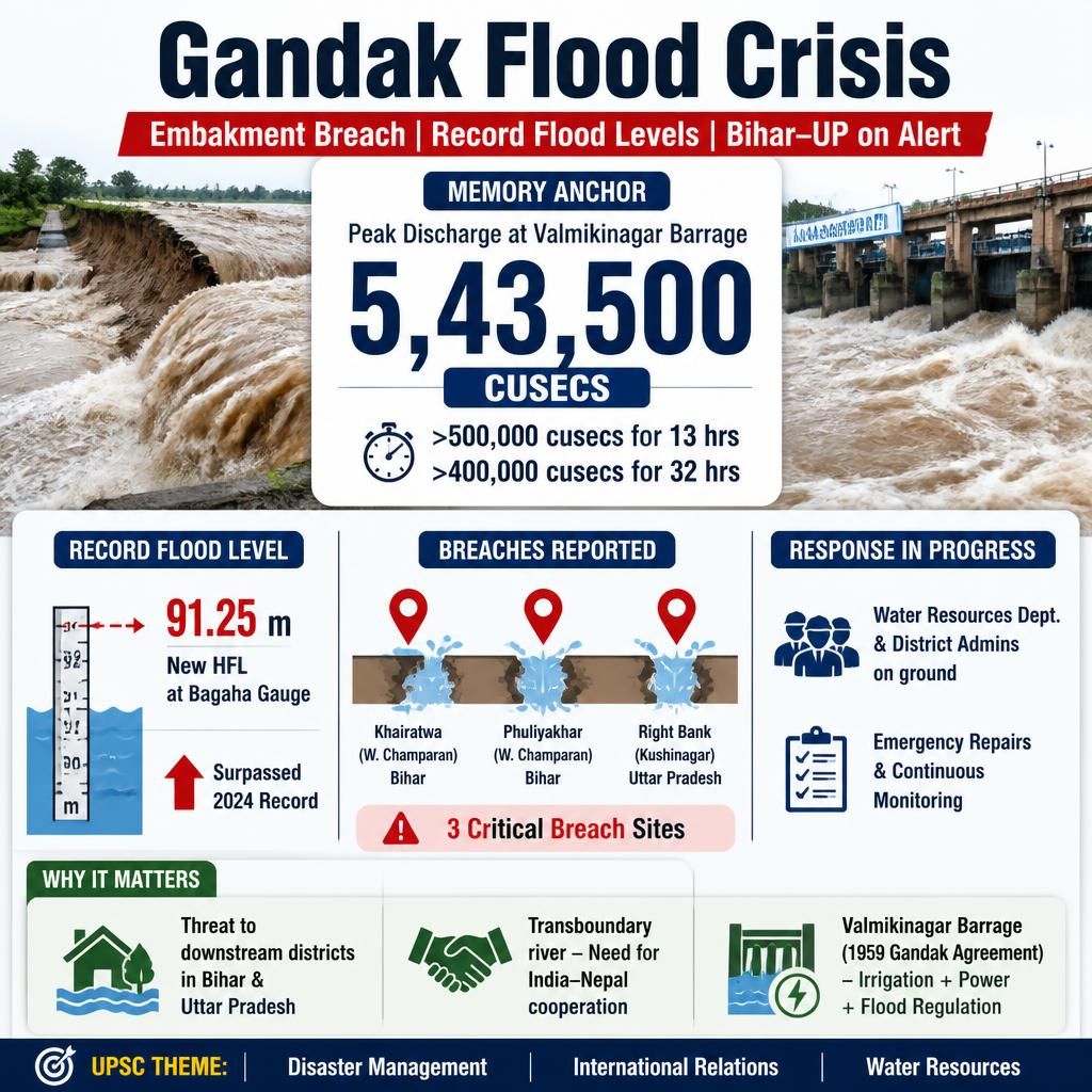
- A massive discharge of 5,43,500 cusecs was recorded at the Valmikinagar Gandak Barrage.
- The river established a new Highest Flood Level (HFL) of 91.25 meters at the Bagaha gauge site, surpassing the previous 2024 record.
- Critical breaches occurred at three sites, including two in West Champaran, Bihar, and one in Kushinagar, Uttar Pradesh.
- The Water Resources Department and district administrations have mobilized teams for emergency repairs and continuous monitoring.
Gandak Flood.jpg
Detailed Insights:
- The Gandak River, also known as Narayani in Nepal, is a significant transboundary left-bank tributary of the Ganga River, originating in the Himalayas.
- The Valmikinagar Gandak Barrage, located near the India-Nepal border in West Champaran, was constructed under the 1959 Gandak Agreement between India and Nepal.
- Its primary functions include regulating river flow, providing irrigation to Bihar, Uttar Pradesh, and Nepal, and generating hydroelectric power.
- During the recent event, the river maintained a discharge exceeding 500,000 cusecs for 13 hours and over 400,000 cusecs for 32 hours.
- The breaches occurred at Khairatwa and Phuliyakhar villages in West Champaran, Bihar, and on the right bank in Kushinagar district, Uttar Pradesh.
- Flood management in Bihar is challenged by its geographical vulnerability, high sediment load in rivers, and the transboundary nature of several major rivers.
- Effective transboundary flood management necessitates cooperation between India and Nepal, as facilitated by existing frameworks like the Gandak Agreement.
- Bihar's flood control strategies involve structural measures like embankment construction and maintenance, alongside non-structural measures such as flood forecasting and disaster preparedness.
Key Concepts Involved:
- Flash Flood: A sudden and rapid flood in a low-lying area, typically caused by intense rainfall.
- Embankment: A protective wall or bank, usually made of earth, built to prevent a river from overflowing its banks.
- Cusecs: A unit of flow rate, representing one cubic foot of water per second, used to measure the discharge of water.
- Highest Flood Level (HFL): The maximum water level recorded at a specific location during a flood event.

SuperKalam is your personal mentor for UPSC preparation, guiding you at every step of the exam journey.
Download the App


STUDY RESOURCES
CONTACT US
ⓒ Snapstack Technologies Private Limited