GS 1: Indian GeographyGS 1: Physical GeographyGS 3: Environment & EcologyPrelimsGS 3: Conservation, Pollution and Degradation
Record Pacific warming sets stage for ferocious El Niño, Pg14
Record Pacific warming sets stage for a 'strong to very strong' El Niño, potentially historic, raising global heatwave and altered rainfall risks.
Practice MCQs
789 Students attempted
Key Highlights:
- The Niño 3.4 region in the central-equatorial Pacific has experienced record-high ocean temperatures, setting the stage for a ferocious El Niño.
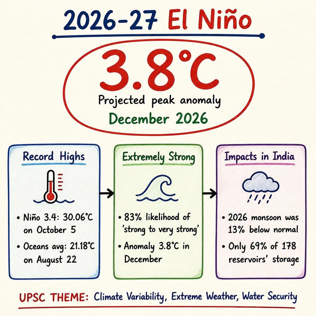
- The world's oceans, excluding polar regions, reached a record average surface temperature of 21.18°C on August 22.
- U.S. NOAA’s Climate Prediction Centre predicts an 83% likelihood of a 'strong to very strong' El Niño, potentially exceeding any event since 1950.
- The Niño 3.4 region recorded a sea surface temperature of 30.06°C on October 5, the first time it exceeded 30°C in recorded history.
- The ongoing 2026-27 El Niño, declared on June 6, is projected to peak in December with a seasonal anomaly of 3.8°C.
El Nino.jpg
Detailed Insights:
- El Niño is a natural climate pattern occurring every two to seven years, influencing global weather and increasing the risk of extreme heatwaves.
- A recent study analyzing coral geochemistry at the Galapagos Islands found a notable amplification of El Niño intensity over the last 40 years.
- Strong El Niño events are characterized by a 90-day average temperature anomaly of 1.5-1.9°C in the Niño 3.4 region, while very strong events exceed 2°C.
- Since the 1980s, only three very strong El Niño events have occurred: 1982-83 (2.1°C), 1997-98 (2.4°C), and 2015-16 (2.6°C).
- El Niño events release stored ocean heat, causing global temperatures to temporarily spike, with 2027 likely to be warmer than 2026.
- The relationship between El Niño and the Indian monsoon is complex; the 2026 monsoon was 13% below normal, but severe drought was averted.
- The Central Water Commission reported that only 69% of India's 178 reservoirs' total storage capacity is filled, with the south facing the largest deficit at 44%.
- The 1982-83 El Niño, the first 'super' event, spurred significant scientific inquiry and improvements in monitoring and prediction.
Key Concepts Involved:
- El Niño: A natural climate pattern characterized by the warming of ocean surface temperatures in the central and eastern tropical Pacific Ocean.
- Niño 3.4 region: A specific area in the central-equatorial Pacific (5°N-5°S, 170°W-120°W) used as the primary index to define El Niño phases.
- Sea Surface Temperature Anomaly: The difference between the observed sea surface temperature and the long-term average for a specific location and time.

SuperKalam is your personal mentor for UPSC preparation, guiding you at every step of the exam journey.
Download the App


STUDY RESOURCES
CONTACT US
ⓒ Snapstack Technologies Private Limited