GS 2: GovernanceGS 1: Indian GeographyGS 3: Disaster ManagementGS 3: Environment & EcologyPrelims
Yamuna floodplains shrank by a third in a century: Study, Pg5
New study warns Delhi's Yamuna floodplains shrunk by a third in a century, as urbanization and barrages escalate flood vulnerability, impacting 2023 floods.
Practice MCQs
731 Students attempted
Key Highlights:
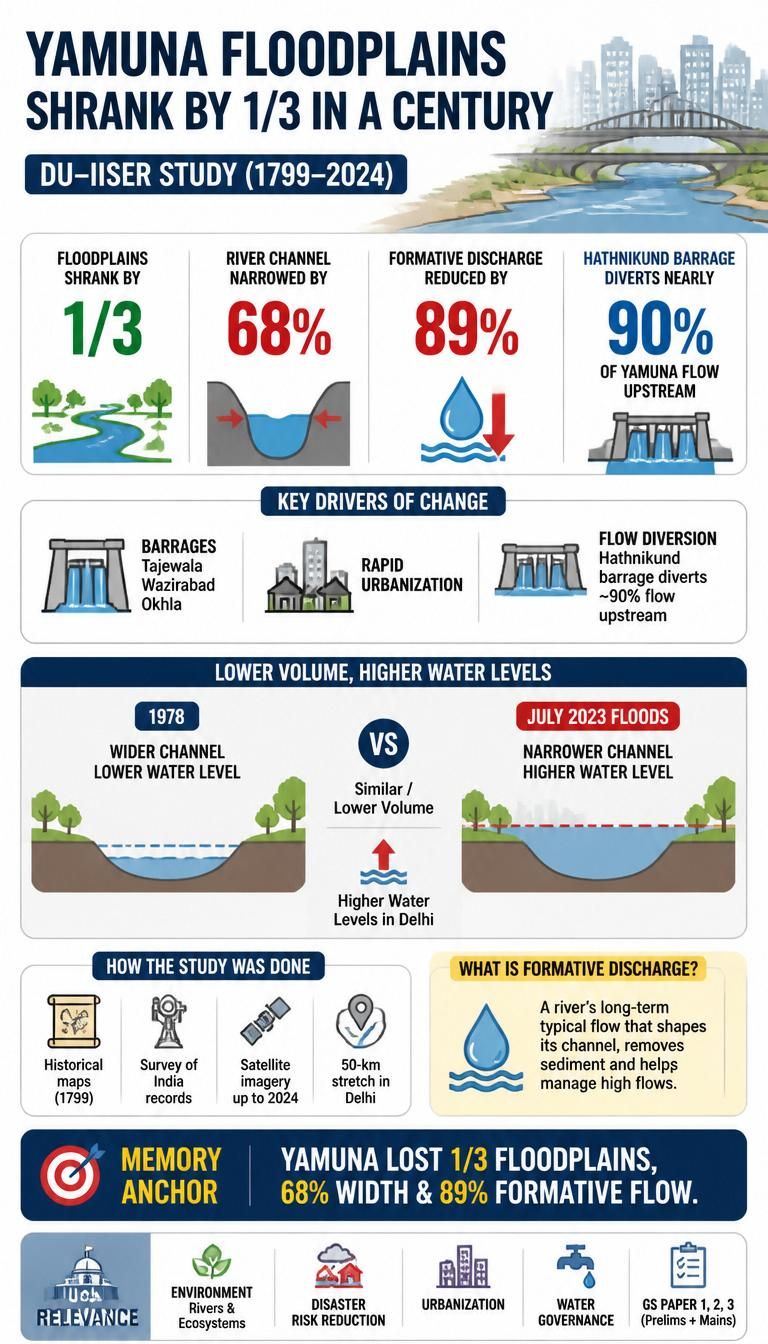
- A study by researchers from the University of Delhi (DU) and the Indian Institute of Science Education and Research (IISER), Bhopal found that Yamuna floodplains in Delhi shrank by one-third over a century.
- The river channel has narrowed by approximately 68%, and its long-term formative discharge has been reduced by nearly 89%.
- Construction of barrages like Tajewala, Wazirabad, and Okhla, along with rapid urbanization, are key drivers of these changes.
- The Hathnikund barrage diverts nearly 90% of the Yamuna's flow upstream, impacting the Delhi stretch.
- The study highlighted that despite lower water volume, the July 2023 floods led to higher water levels in Delhi compared to 1978 due to river constriction.
Yamuna.jpg
Detailed Insights:
- The study analyzed a 50-km stretch of the Yamuna in Delhi using historical maps from 1799, Survey of India records, and satellite imagery up to 2024.
- Formative discharge is crucial for a river's natural ability to shape its channel, remove sediment, and manage high flows.
- Around 45 sq km of the river's floodplains in Delhi have been disconnected by embankments over the last century.
- These disconnected floodplains have been encroached upon for agriculture, settlements, and infrastructure development.
- Sediment deposits within the river have significantly declined from 20 sq km in 1985 to about 4 sq km in 2020.
- The constriction of the river corridor by embankments and urban development prevents floodwaters from spreading laterally, increasing flood vulnerability.
- Recommendations for improving river health include upgrading sewage treatment plants and increasing the use of treated wastewater.
- Improving major drains like the Najafgarh (Sahibi) drain and reducing Delhi's dependence on the Yamuna for freshwater are also suggested.
- The study emphasizes the need for a "long-term hydrogeomorphic perspective" to understand the river's degradation.
Key Concepts Involved:
- Formative Discharge: The long-term average flow that naturally shapes a river channel and maintains its capacity.
- Hydrogeomorphic Evolution: The process by which evolving landforms dictate water flow and shape a river's physical characteristics.
- Floodplains: Flat land areas adjacent to a river, formed by the deposition of sediment, which naturally accommodate floodwaters.
- Environmental Flows: The quantity, timing, and quality of water flows required to sustain freshwater and estuarine ecosystems.

SuperKalam is your personal mentor for UPSC preparation, guiding you at every step of the exam journey.
Download the App


STUDY RESOURCES
CONTACT US
ⓒ Snapstack Technologies Private Limited