GS 1: World GeographyPrelimsGS 2: Important International Institutions, Agencies and ForaGS 1: Salient Features of World's Physical Geography
Brave New World Map, Pg2
UN endorses Equal Earth projection to replace distorted Mercator maps, accurately depicting landmasses like Africa, 14 times larger than Greenland.
Practice MCQs
833 Students attempted
Key Highlights:
- The United Nations endorsed the Equal Earth projection as a more accurate world map on September 4, 2026.
- This move encourages governments and institutions to replace the traditional Mercator projection, which has been in use since the 16th century.
- The Equal Earth projection more accurately represents the relative sizes of continents, highlighting that Africa is 14 times larger than Greenland.
- The resolution, titled "Correct the Map," was adopted by 164 votes in favor, with the United States casting the sole vote against, and six countries abstaining.
- The UN resolution is non-binding, encouraging rather than mandating the use of the new projection.
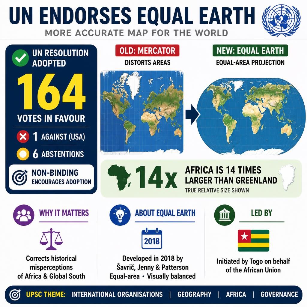
Equal Earth Projection.jpg
Detailed Insights:
- The Mercator projection, developed by Gerardus Mercator in 1569, was primarily designed for maritime navigation due to its ability to preserve angles and directions.
- However, the Mercator projection significantly distorts the area of landmasses, particularly exaggerating the size of regions farther from the equator, such as Greenland and Canada.
- The Equal Earth projection was developed in 2018 by Bojan Šavrič, Bernhard Jenny, and Tom Patterson, aiming to provide an equal-area representation with a visually pleasing aesthetic.
- This new projection is a pseudocylindrical equal-area map, meaning it accurately preserves the relative sizes of continents and countries.
- The initiative to adopt the Equal Earth projection was spearheaded by Togo on behalf of the African Union, seeking to correct historical misperceptions of Africa's size and importance.
- While the Equal Earth projection minimizes area distortion, it still involves some distortion of shapes and distances, particularly towards the poles, as no flat map can perfectly represent a three-dimensional sphere.
- The UN's encouragement is expected to influence educational curricula and digital mapping platforms, promoting a more accurate global geographical understanding.
Key Concepts Involved:
- Map Projection: A systematic method of representing the three-dimensional surface of the Earth or another celestial body on a two-dimensional plane, inevitably involving some distortion.
- Mercator Projection: A cylindrical map projection that preserves angles and directions, making it useful for navigation, but significantly distorts the relative sizes of landmasses, especially near the poles.
- Equal-Area Projection: A type of map projection that accurately represents the relative sizes of geographical features, ensuring that any area on the map is proportional to its corresponding area on the Earth's surface.

SuperKalam is your personal mentor for UPSC preparation, guiding you at every step of the exam journey.
Download the App


STUDY RESOURCES
CONTACT US
ⓒ Snapstack Technologies Private Limited